MOERS (DE) - 2010-06-20 01:42:19
- Magnitude 2.4
Last update : 2010-06-29 03:05:20 Belgian time
Main parameters
| Date and time |
2010-06-20 01:42:19 UTC
2010-06-20 03:42:19 Belgian time |
| Type | Known induced event |
| Magnitude | ML 2.4 |
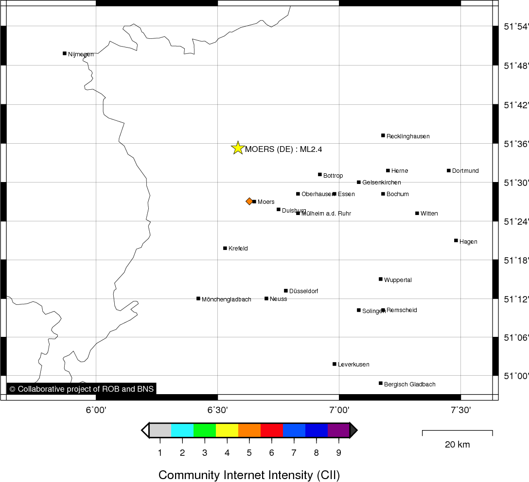
| Region | MOERS (DE) |
| Epicentral coordinates | 51.588° N, 6.584° E Uncertainty ± 5.8 km |
| Depth of hypocenter | 14.6 ± 6.9 km |
Data source : ROB (Royal Observatory of Belgium)
Location map
Quake measurements
Measurements by the Belgian seismic network
| Station | Epicentral distance (km) |
P-Wave arrival (hh:mm:ss.ss) | S-Wave arrival (hh:mm:ss.ss) | Maximal ground displacement (nm) |
|
|---|---|---|---|---|---|
| Code | Place | ||||
| HRK | HERKENBOSCH | 53 | 01:42:27.35 | - | - |
| EBN | EBEN-EMAEL | 109 | 01:42:37.35 | 01:42:50.27 | - |
| MEMS | MEMBACH | 116 | 01:42:37.71 | 01:42:52.12 | 107.7 |
| LCH | LA CHARTREUSE | 126 | 01:42:39.91 | - | - |
| STI | SART TILMAN | 133 | 01:42:41.35 | 01:42:56.93 | - |
| KLB | KALBORN | 169 | 01:42:45.92 | 01:43:05.18 | - |
| GES | GESVES | 170 | 01:42:46.15 | 01:43:06.48 | 19.9 |
| VIA | VIANDEN | 186 | 01:42:47.70 | 01:43:07.76 | - |
| SNF | SENEFFE | 201 | 01:42:50.13 | - | - |
Macroseismic
Data
| Total number of responses | 1 |
|---|---|
| Intensity V | 1 |
Attention! The intensities derived from the macroseismic enquiry are raw unverified data.
Map
Data policy
Please read on this notice to learn more about our data policy.