KOBLENZ (DE) - 2011-02-14 12:50:43
- Magnitude 2.6
Last update : 2016-11-24 12:10:13 Belgian time
Main parameters
| Date and time |
2011-02-14 12:50:43 UTC
2011-02-14 13:50:43 Belgian time |
| Type | Earthquake |
| Magnitude | ML 2.6 |
| Maximal intensity | III |
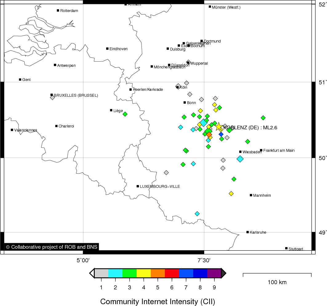
| Region | KOBLENZ (DE) |
| Epicentral coordinates | 50.412° N, 7.806° E Uncertainty ± 3.8 km |
| Depth of hypocenter | 7.0 ± 3.4 km |
Location map
Quake measurements
Measurements by the Belgian seismic network
| Station | Epicentral distance (km) |
P-Wave arrival (hh:mm:ss.ss) | S-Wave arrival (hh:mm:ss.ss) | Maximal ground displacement (nm) |
|
|---|---|---|---|---|---|
| Code | Place | ||||
| VIA | VIANDEN | 126 | 12:51:03.43 | 12:51:19.18 | 195 |
| KLB | KALBORN | 126 | 12:51:04.09 | 12:51:19.24 | 75 |
| MEMS | MEMBACH | 129 | 12:51:05.17 | 12:51:20.06 | 197 |
| WLF | WALFERDANGE | 145 | 12:51:05.79 | 12:51:25.15 | 173 |
| EBN | EBEN-EMAEL | 157 | 12:51:08.73 | 12:51:26.87 | 34.5 |
| STI | SART TILMAN | 160 | 12:51:09.75 | 12:51:28.44 | 18.5 |
| CLA | CLAVIER | 178 | 12:51:12.08 | 12:51:31.61 | 27 |
| GES | GESVES | 193 | 12:51:13.74 | 12:51:34.68 | 36 |
| MRD | MAREDSOUS | 216 | 12:51:16.34 | 12:51:43.72 | - |
| DOU | DOURBES | 231 | 12:51:17.94 | 12:51:31.61 | - |
| SNF | SENEFFE | 250 | 12:51:22.63 | - | - |
Macroseismic
Data
| Total number of responses | 77 |
|---|---|
| Intensity I | 23 |
| Intensity II | 10 |
| Intensity III | 28 |
| Intensity IV | 14 |
| Intensity V | 1 |
| Intensity VII | 1 |
Attention! The intensities derived from the macroseismic enquiry are raw unverified data.
Map
Data policy
Please read on this notice to learn more about our data policy.