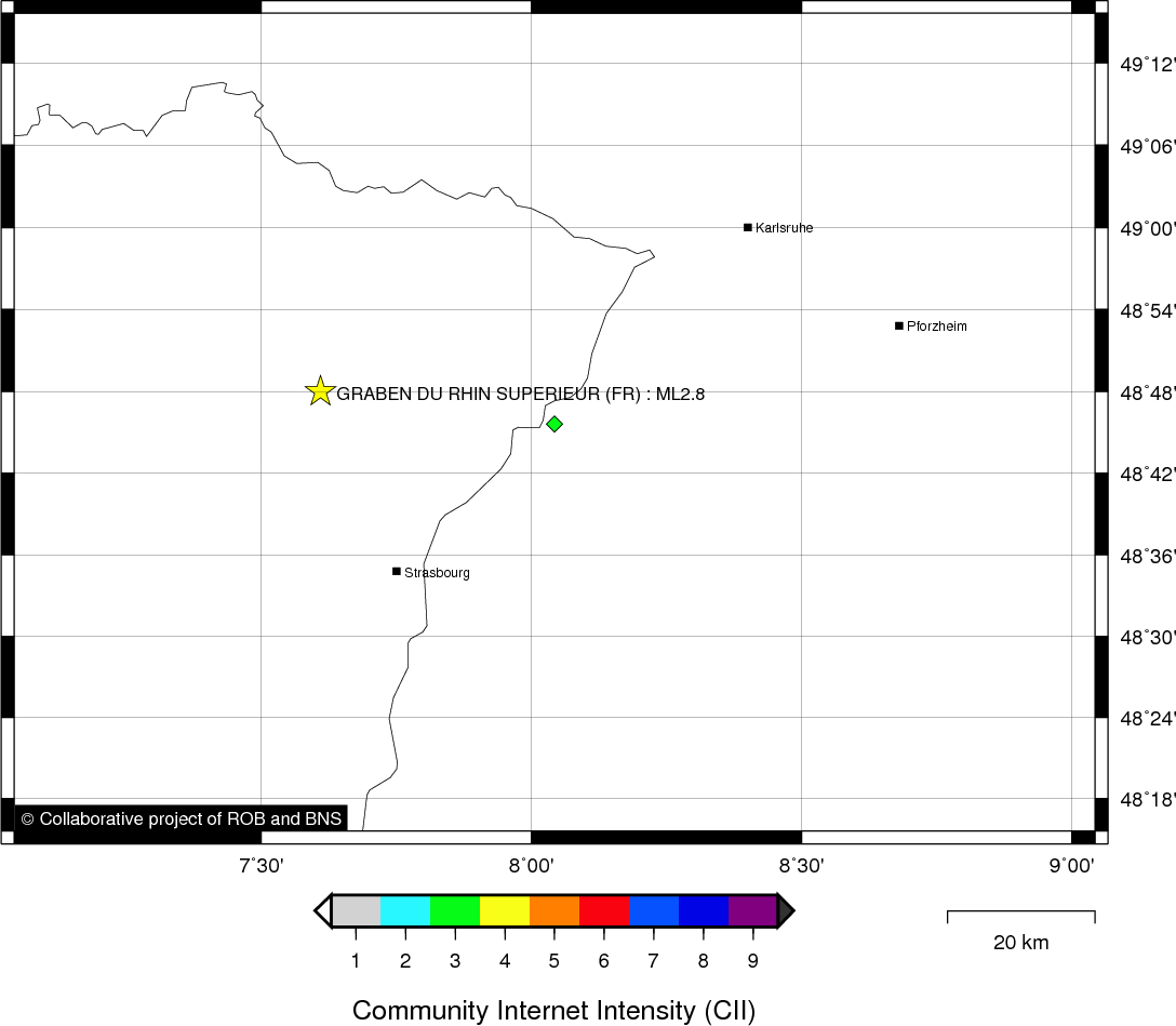
GRABEN DU RHIN SUPERIEUR (FR) - 2010-07-30 01:56:14
- Magnitude 2.8
Last update : 2021-08-24 15:00:18 Belgian time
Main parameters
| Date and time |
2010-07-30 01:56:14 UTC
2010-07-30 03:56:14 Belgian time |
| Type | Earthquake |
| Magnitude | ML 2.8 |
| Region | GRABEN DU RHIN SUPERIEUR (FR) |
| Epicentral coordinates | 48.800° N, 7.610° E Uncertainty ± 5.0 km |
| Depth of hypocenter | 8.0 ± 5.0 km |
Data source : EMSC (European-Mediterranean Seismological Centre)
Location map
Quake measurements
Measurements by the Belgian seismic network
| Station | Epicentral distance (km) |
P-Wave arrival (hh:mm:ss.ss) | S-Wave arrival (hh:mm:ss.ss) | Maximal ground displacement (nm) |
|
|---|---|---|---|---|---|
| Code | Place | ||||
| WLF | WALFERDANGE | 143 | 01:56:36.92 | 01:56:54.88 | 307.5 |
| MEMS | MEMBACH | 232 | 01:56:47.46 | 01:57:18.10 | 76 |
| EBN | EBEN-EMAEL | 262 | 01:56:51.83 | 01:57:18.10 | 33.2 |
| DOU | DOURBES | 262 | 01:56:52.08 | 01:57:19.11 | - |
Macroseismic
Data
| Total number of responses | 2 |
|---|---|
| Intensity II | 1 |
| Intensity III | 1 |
Attention! The intensities derived from the macroseismic enquiry are raw unverified data.
Map
Data policy
Please read on this notice to learn more about our data policy.