MOERS (DE) - 2011-02-02 17:23:46
- Magnitude 2.9
Last update : 2016-11-24 12:09:40 Belgian time
Main parameters
| Date and time |
2011-02-02 17:23:46 UTC
2011-02-02 18:23:46 Belgian time |
| Type | Known induced event |
| Magnitude | ML 2.9 |
| Maximal intensity | III |
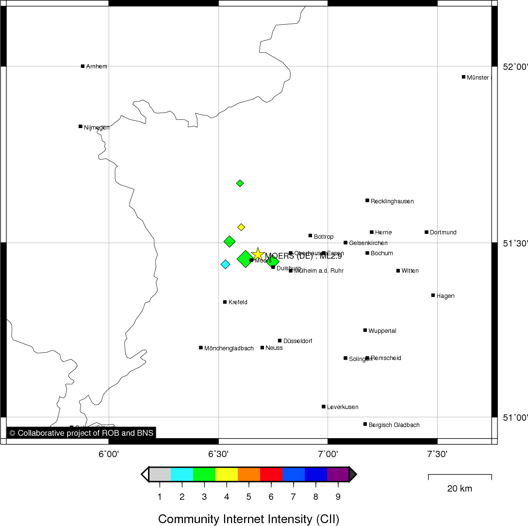
| Region | MOERS (DE) |
| Epicentral coordinates | 51.466° N, 6.681° E Uncertainty ± 6.8 km |
| Depth of hypocenter | 3.3 ± 6.3 km |
Data source : ROB (Royal Observatory of Belgium)
Location map
Quake measurements
Measurements by the Belgian seismic network
| Station | Epicentral distance (km) |
P-Wave arrival (hh:mm:ss.ss) | S-Wave arrival (hh:mm:ss.ss) | Maximal ground displacement (nm) |
|
|---|---|---|---|---|---|
| Code | Place | ||||
| HRK | HERKENBOSCH | 47 | 17:23:54.55 | 17:24:00.67 | 156.8 |
| EBN | EBEN-EMAEL | 102 | 17:24:03.85 | 17:24:15.19 | 246.1 |
| MEMS | MEMBACH | 106 | 17:24:04.24 | - | - |
| DSLB | DESSEL | 115 | 17:24:05.83 | 17:24:18.68 | - |
| LCH | LA CHARTREUSE | 119 | 17:24:06.41 | - | - |
| CLA | CLAVIER | 151 | 17:24:10.97 | 17:24:29.73 | 156 |
| KLB | KALBORN | 157 | 17:24:12.39 | 17:24:31.28 | 340.3 |
| DOU | DOURBES | 212 | 17:24:18.65 | - | - |
Macroseismic
Data
| Total number of responses | 44 |
|---|---|
| Intensity I | 3 |
| Intensity II | 5 |
| Intensity III | 16 |
| Intensity IV | 16 |
| Intensity V | 4 |
Attention! The intensities derived from the macroseismic enquiry are raw unverified data.
Map
Data policy
Please read on this notice to learn more about our data policy.